The high level route: Saas-Fee to Argentière variant.
We are back from a one week hut-trip traversing the Alps from Saas-Fee (CH) to Argentière (FR): Unfortunately weather and snow situation were not on our side. Out of eight, we only had two bluebird days. On the others poor visibility, partly snowfall and often strong wind overweighed.
The “Haut Route” as this tour is commonly known, is not famous for the skiing, but the impressions you collect along the way. Even the few rewarding skiing parts were to risky during our attemp. So allthough we reached our final destination in Argentiere, we weren’t able to stay on the originally intended route.
The Haute Route ski tour is probably the most famous and coveted ski tour in the world. Using high mountain huts to allow skiers to stay high and cover substantial distances, it winds through the highest, most dramatic peaks of the Alps from Mont Blanc to the Matterhorn. It requires good weather, favourable snow conditions and strong effort to complete this line. Because of this, roughly half of the skiers who begin the tour do not complete it.
– description from en.wikipedia.org
Some defining moments of one week winderly high alpine glacier travel:
(Click for high-resolution pictures)
After starting not too early from our hotel in Champex and a nice walk through Val d’Arpette we reach Col des Ecandies around noon
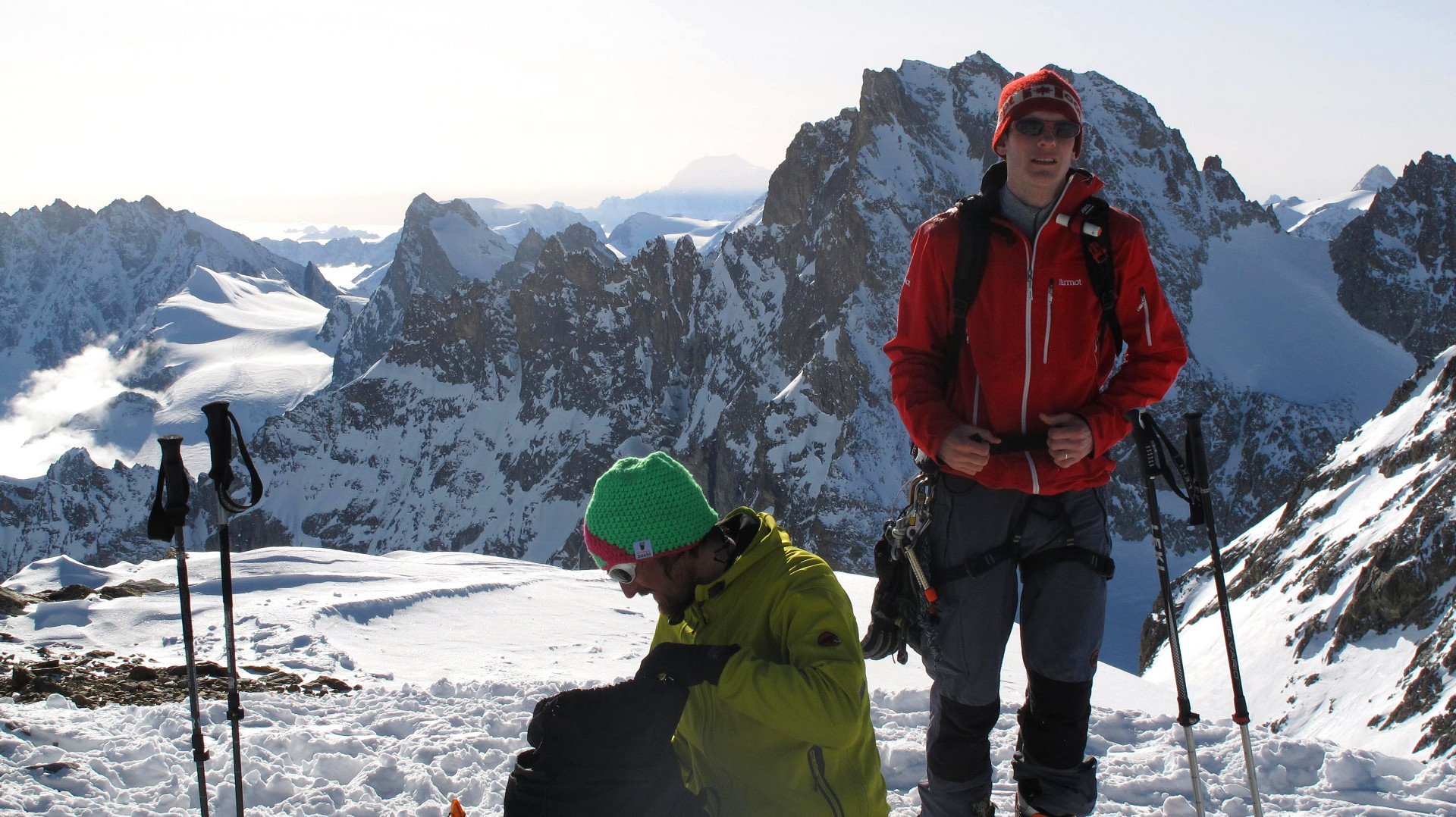
Summit view south from Aiguille de Tour at about 9am the last day. ~2h hike from Cab. du Trient
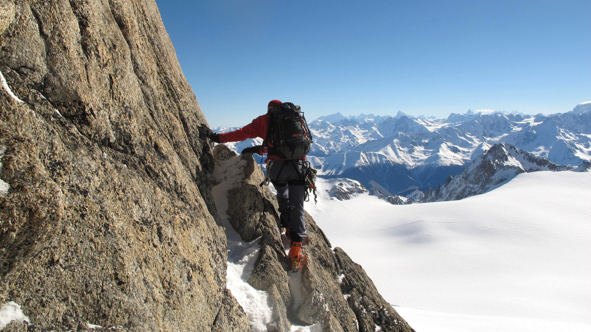
Descending from Aig. du Tour summit in easy climbing terrain.

Aig. Purtscheller in front of Aig. d’Argentière

Fenêtre de Saleina from Plateau du Trient: The other side was tracked and refrozen 40° terrain which we decended without crampons. Not a good idea..
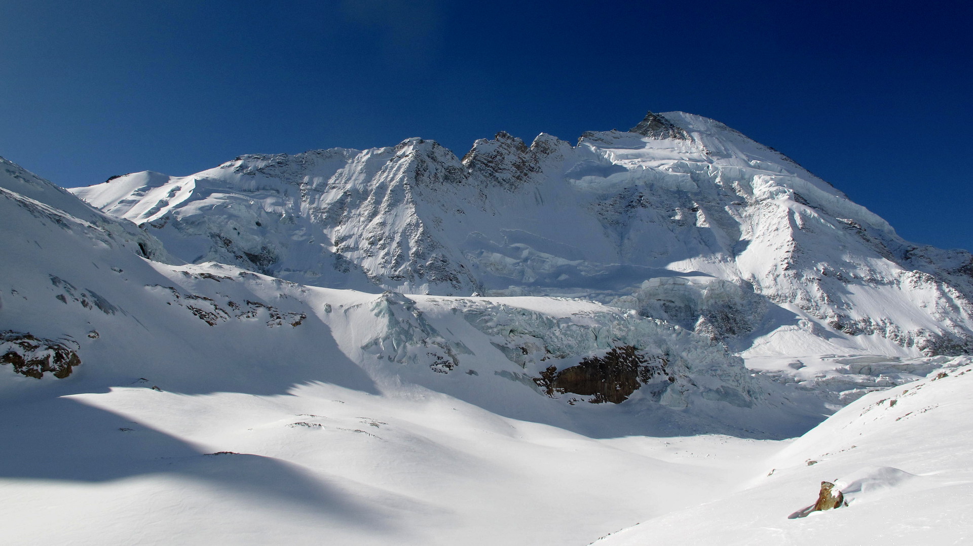
That day we left the hostel in Zermatt at 5:15am, made it all the way up the “Zmutt” glacier, left the Matterhorn behind us, to have a nice morning break below the impressive north face of Dent d’Hérens
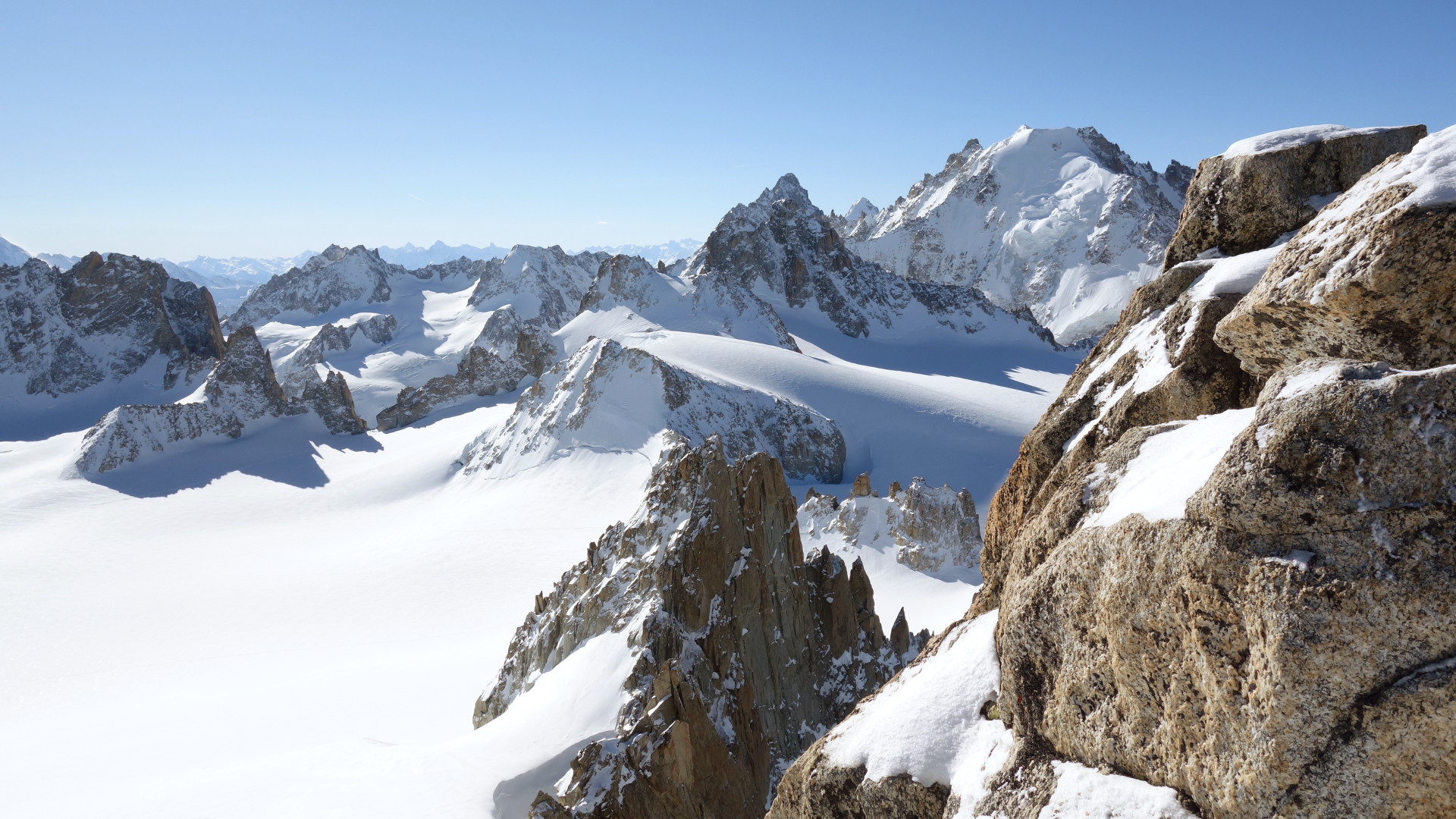
A couple of hours later we stood on Tête Blanche with a fantastic 360° view
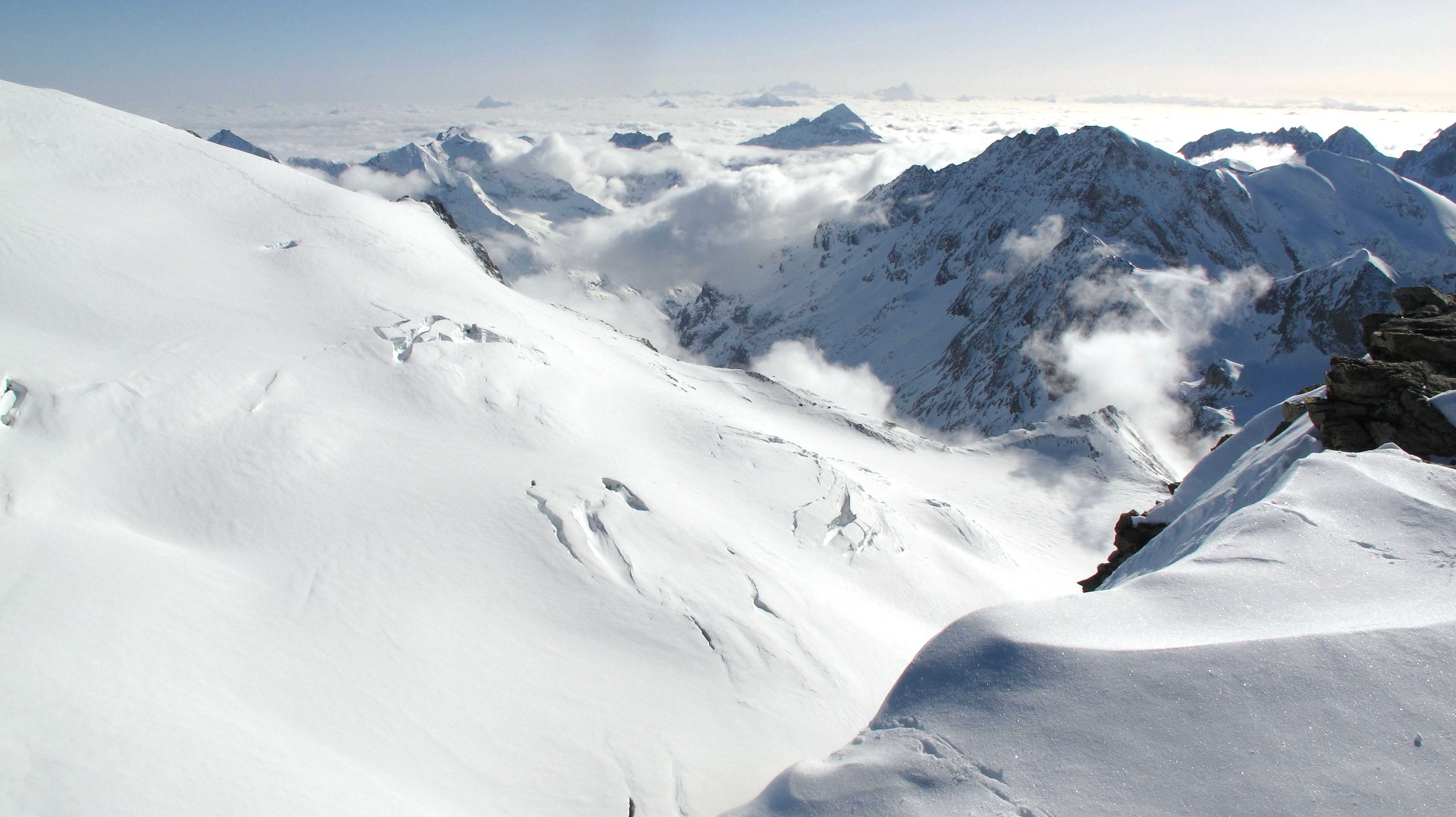
View from Tête Blanche south to the cloud-covered Valle d’Aosta and Gran Paradiso with neighbouring peaks.

Cabane de Bertol in the late afternoon sun light. We reach it after more than 20k’s, 2000m+ vertical and half a day of walking. The biggest day.

A true classic SAC hut: Cab. des Vignettes, high above Arolla and at the foot of the Pigne d’Arolla. We are the only guests that day. In the center one can divine Cab. Bertol which we left in the morning.
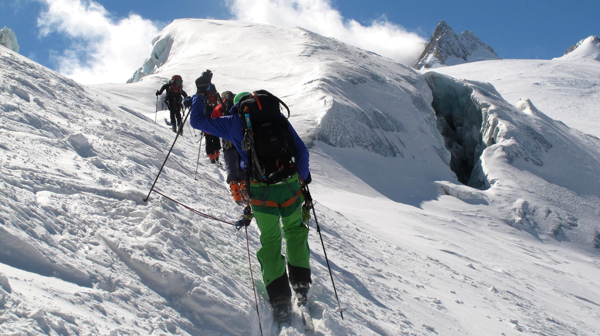
Roped up in the fracture zone of Glacier du Trient

A bewiched moment when we arrived on the Plateau du Trient, the sky cleared and we spotted the Aiguilles Dorées the first time
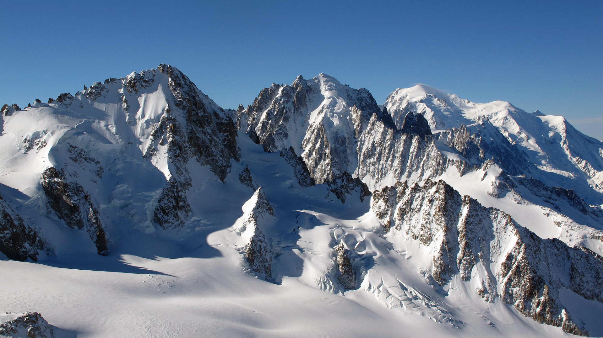
Aiguille du Chardonnet, Aiguille Verte and Mont Blance seen from Aiguille du Tour
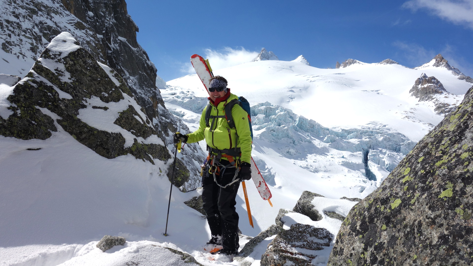
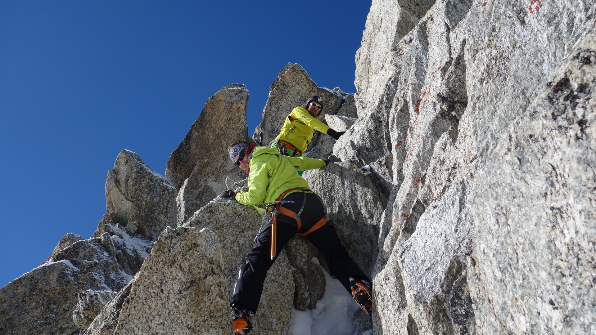
A day for aficionados: Sunny scrambling above Trient hut
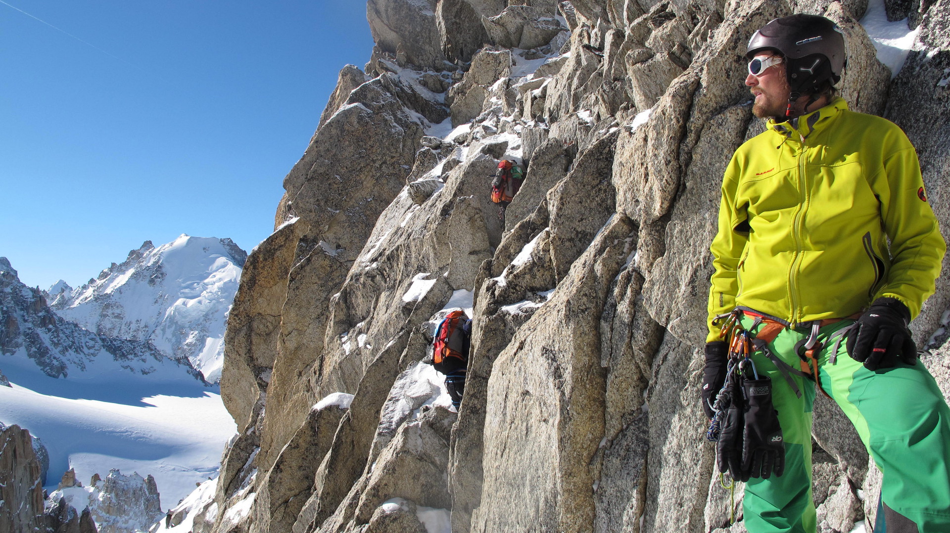
Easy but sometimes a bit exposed: the rocky part on Aig. du Tour

hey! super blog, tolle touren, schöne bilder! toll auch, dass es bei euch trotz der mäßigen verhältnisse dieses jahr mit der haute route geklappt hat. wir haben dieses jahr gekniffen… wenn du magst, guck doch mal auf meinem “blog” vorbei: instagram.com/jrg187
viele grüße,
jörg
Danke dir!